
search
Amsterdam ferry map
Map of Amsterdam ferry. Amsterdam ferry map (Netherlands) to print. Amsterdam ferry map (Netherlands) to download. Three free ferries carry pedestrians and cyclists across the IJ to Amsterdam-Noord, and two fare-charging ferries run east and west along the harbour as its shown in Amsterdam ferry map. Amsterdam ferries provide essential, free connections across the River IJ for pedestrians, cyclists and mopeds. Many of these blue-and-white ferries can be found directly behind Amsterdam Central Station, providing a frequent and free service across the water to and from Amsterdam Noord.
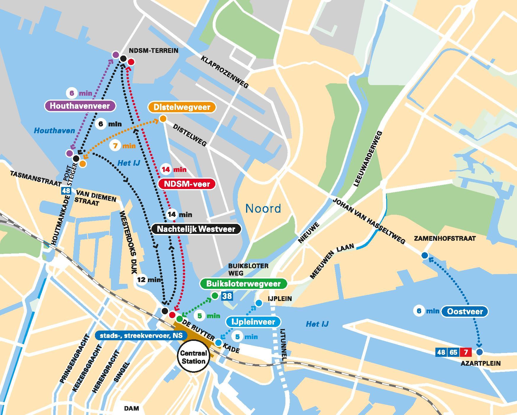
The most popular and best-served ferry route is from Amsterdam Central Station to Buiksloterweg (ideal for attractions such as the Eye Filmmuseum and Tolhuistuin) as its shown in Amsterdam ferry map. A number of Amsterdam ferries operate on this short route meaning you rarely have to wait more than a few minutes to step aboard (a countdown clock displaying the destination and remaining time until the next departure is shown above each docking spot). This route is also served throughout the night.