
search
Port of Amsterdam map
Amsterdam docks map. Port of Amsterdam map (Netherlands) to print. Port of Amsterdam map (Netherlands) to download. The Port of Amsterdam is a multifunctional port capable of handling, storing and shipping cargoes ranging from cocoa beans to coal, and from paper to oil. The Amsterdam port is served by three types of terminals for breakbulk, containers and energy as its shown in port of Amsterdam map. The Koopman Car Terminal has a surface area of 350,000m2. The port of Amsterdam maximum depth is 12m and quay length is 350m. Automotive stevedore and RO/RO activities are performed here.
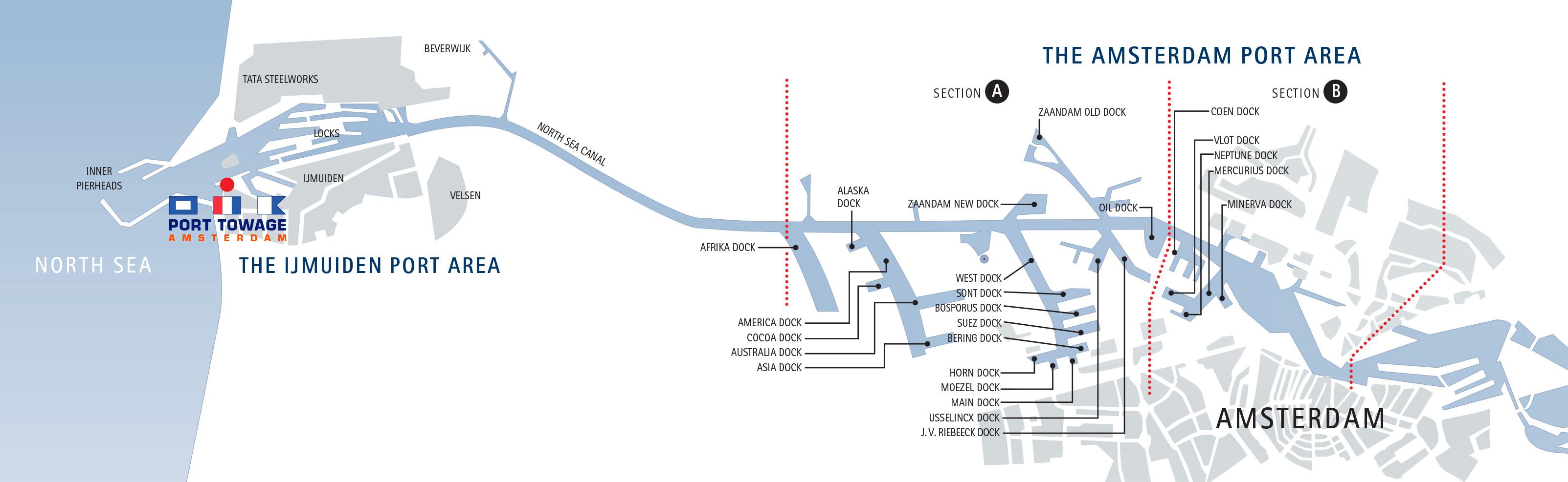
The Port of Amsterdam is a tideless port located on the banks of the North Sea Canal and IJsselmeer, a shallow artificial lake located in the northwest part of the Netherlands. The Amsterdam port is connected to major international transport flows such as the North Sea, Den Helder, Markermeer, IJsselmeer and the River Rhine as its shown in port of Amsterdam map. The Amsterdam port is the second largest in the Netherlands in terms of transshipment. It is ranked fourth among European ports. In the first half of 2011, the port handled 37.5 million tons of cargo, an increase of 5.7% compared to the first half of 2010.
The Port of Amsterdam comprises 680ha of water surface and 1,960ha of land area that consists of port sites, quaysides, roads, railways and dikes as its mentioned in port of Amsterdam map. Of the total land area, 310ha is allocated for infrastructure, 1,305ha is issued for business sites and 345ha is available for rent or lease. The Amsterdam port can be accessed from the sea as well as from inland waters. The sea route access is through the North Sea Canal. Oranje locks and Amsterdam Rhine canal provides access from inland waters. The maximum draught reserved to use the lock is 13.72m. The North Sea Canal is 275m wide and 20km long at the approach.