
search
Amsterdam rail map
Amsterdam light rail map. Amsterdam rail map (Netherlands) to print. Amsterdam rail map (Netherlands) to download. Amsterdam has a number of rail lines and train stations operated by the Dutch national rail company NS (Nederlandse Spoorwegen) as its shown in Amsterdam rail map. The main hub is Amsterdam Central (Amsterdam Centraal) station on the northern edge of the city centre – here you will also find trams, buses, ferries and the metro. Our exclusive map below details the basic rail and train station network around Amsterdam – which could be useful if you are not familiar with the city.
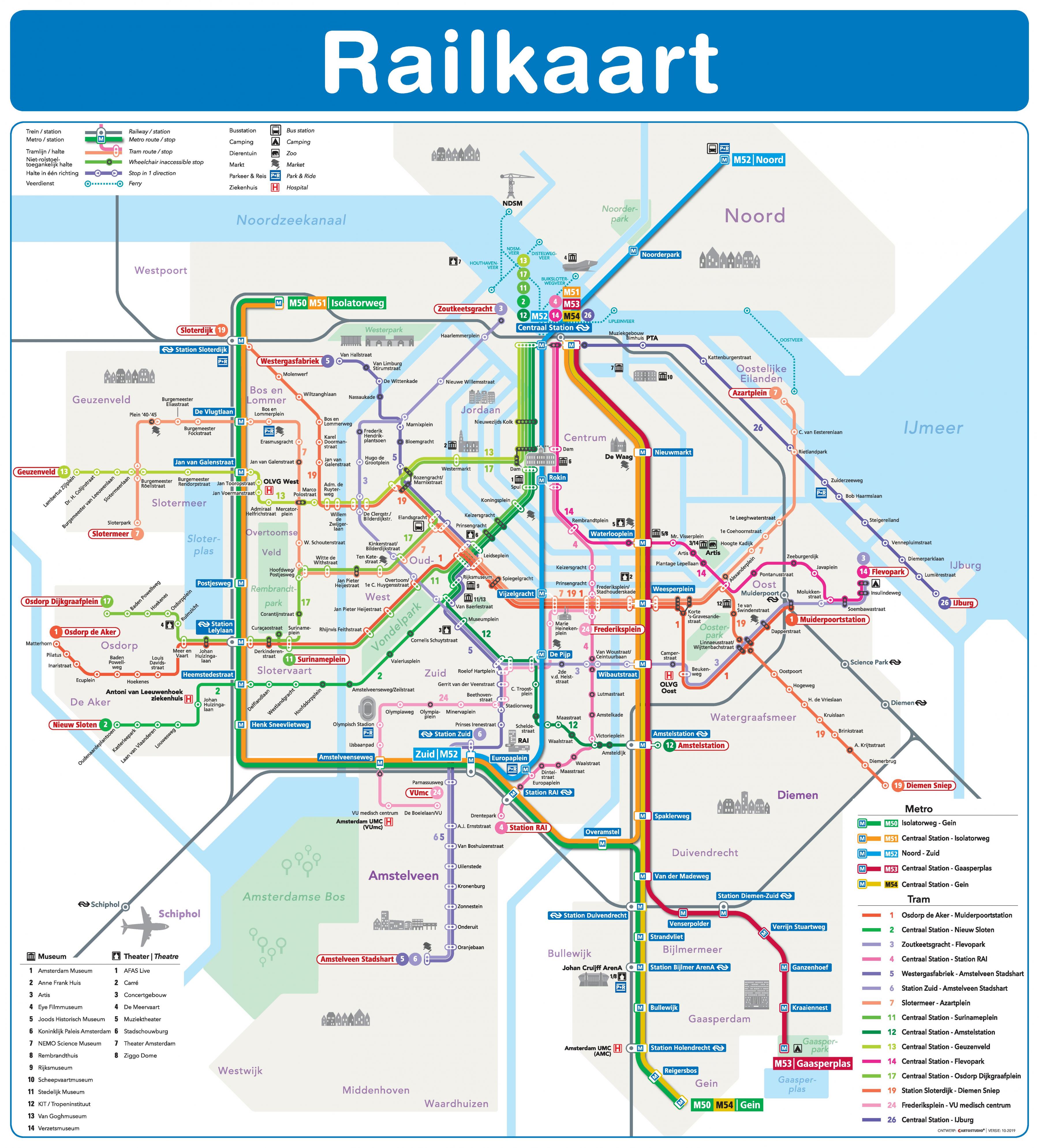
Trains between Schiphol airport and Amsterdam Central station run via the line through Amsterdam Lelylaan and Amsterdam Sloterdijk as you can see in Amsterdam rail map. If you need to travel from Schiphol Airport to Amsterdam Zuid (business district), Amsterdam RAI (Convention and Exhibition Centre) or Bijlmer-ArenA (stadium/events area) you need to take the separate southern rail line.
Schiphol Airport is also a major rail hub in Amsterdam rail map with direct trains to many Dutch cities including Utrecht and Eindhoven, Leiden and Den Haag. There is a high-speed rail track running south-west from near Amsterdam Schiphol Airport. It is used by the domestic Intercity Direct service to Rotterdam/Breda; the Intercity Brussels to Antwerp/Brussels; the Thalys to Antwerp/Brussels/Paris and the Eurostar to Brussels/London.