
search
Tram 2 Amsterdam map
Tram 2 Amsterdam route map. Tram 2 Amsterdam map (Netherlands) to print. Tram 2 Amsterdam map (Netherlands) to download. Tram 2 Amsterdam run from Amsterdam Central to Nieuw Sloten via Dam/Nieuwezijds Kolk/Spui/Koningsplein/Leidseplein/Rijksmuseum/Van Baerlestraat (Van Gogh Museum/Stedelijk)/Koninginneweg (Vondelpark area)/Hoofddorpplein/Oudenaardeplantsoen (Nieuw Sloten) – listed by National Geographic as one of the top 10 ‘trolley’ (tram 2 Amsterdam) rides in the world no less.
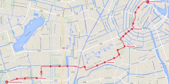
According to the the National Geographic Traveler magazine, route 2 in Amsterdam is one of the most beautiful in the world as its shown in tram 2 Amsterdam map. Amsterdam shares company with cities like New Orleans, Budapest and Berlin when it comes to beautiful tram routes. Go for a ride sometime on tram 2. The first part of the Amsterdam tram route 2 from Central Station to the Hoofddorpplein takes you along plenty of sights worth seeing, such as, the Vondelpark, the canals, the Rijksmuseum, and the Stedelijk and Van Gogh museums.