
search
Amsterdam parking map
Parking map Amsterdam. Amsterdam parking map (Netherlands) to print. Amsterdam parking map (Netherlands) to download. The city of Amsterdam was not designed for driving. To park in Amsterdam, it is therefore advisable to target the outskirts and then explore the city center by bike, streetcar, bus or metro as its shown in Amsterdam parking map. Parking in Amsterdam is mostly located around the A10 and A2 ring roads. Open 24 hours a day, they are called "P + R" (acronym for "Parkeren en Reizen", "park and ride").
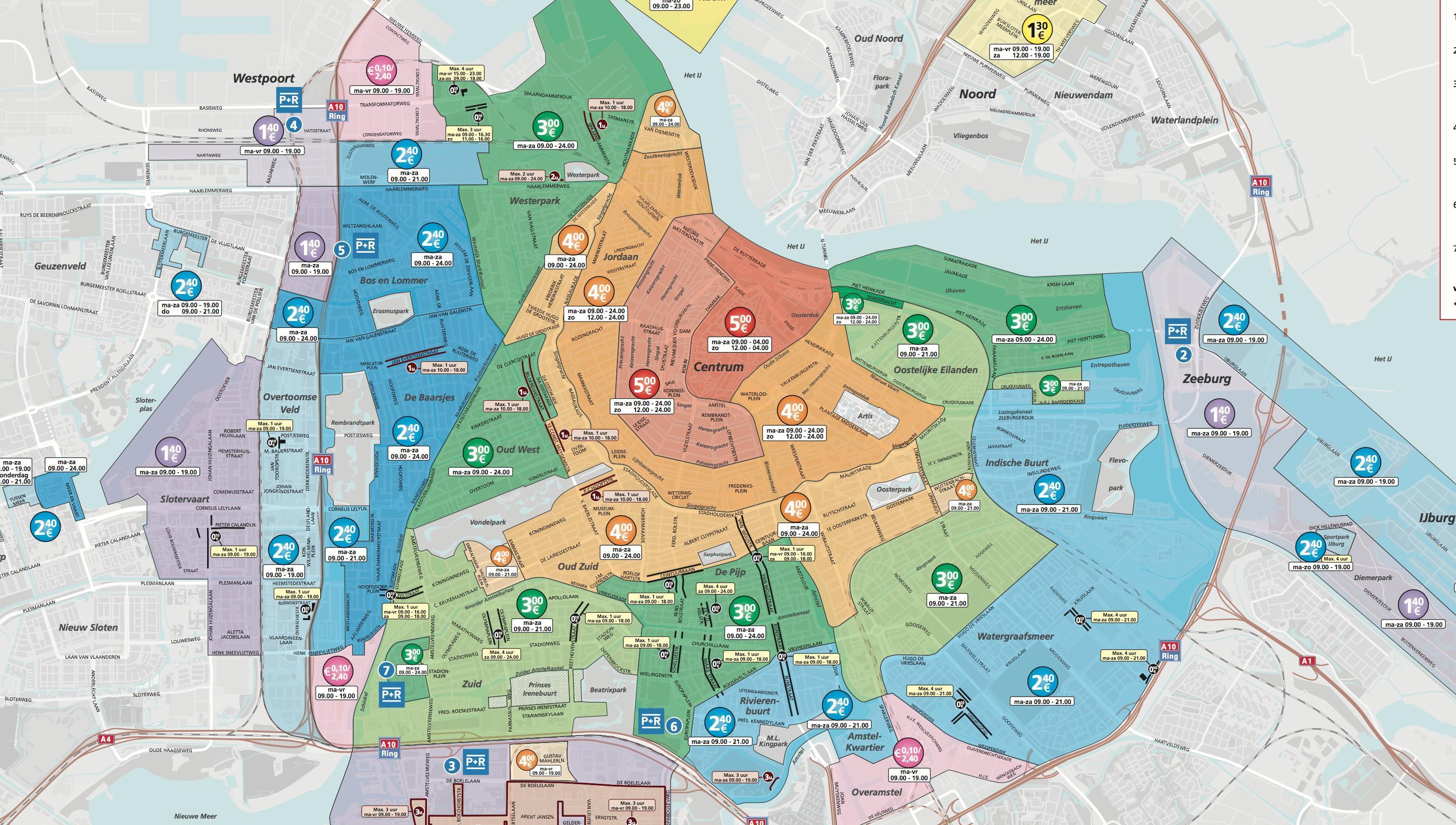
The P+R offer very low rates - 1 € for 24 hours - for a total of 96 hours (sometimes 24 hours, inquire depending on the parking in Amsterdam). There are a total of seven parking lots in Amsterdam (P+R) in the south, west and east of the city as its mentioned in Amsterdam parking map. However, if you wish to park in the city center of Amsterdam, there are still a few parking spaces available, although this will be - we have warned you - as complicated as it gets.
The P+R Olympish Stadion wich is located in the south-west as its shown in Amsterdam parking map is the most crowded: it is therefore recommended to move to another P+R in case of heavy traffic (sports or cultural events in particular). A computer graphic (only in Dutch) allows you to visualize in real time the number of places available in one of Amsterdam parking lots. It is also recommended to download in advance the map of the parking lots in Amsterdam.